§ spiral walks
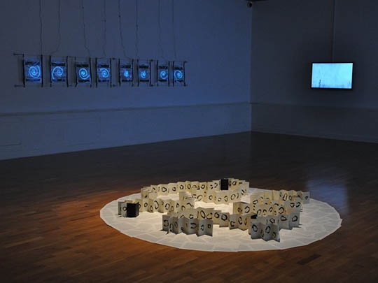
Spiral Walks is a series of 8 illuminated maps of symbolic walks that are the memories of playful interventions into the environment of the upper Calder Valley in West Yorkshire.
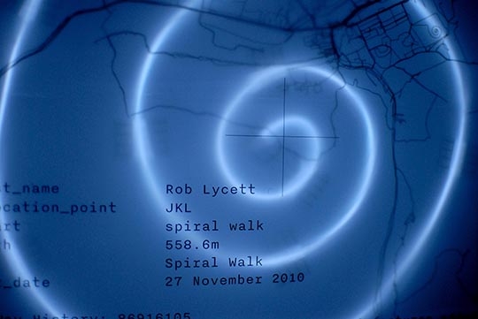
A series of spiral walks were made between 2010 and 2013, and recorded as gps tracks. In the spirit of Robert Smithson, each spiral rotated around a symbolic ‘dislocation point’ (object, person, artefact). The spiral walks were contributed to the Openstreetmap database as pieces of ‘land art’ by the artist, with their dislocation point honoured.
The spiral walks were purged from the Openstreetmap (as un-surveyable features) in the autumn of 2013, but their memory remains within the database and they are commemorated in the form of illuminated spiral map artefacts.
The first of the spiral walks was made on Crow Hill on the 27th November, 2010.
Exhibition history >>
08.02.2014 to 03.05.2014
trace.[instructions for mapping space]
Huddersfield Art Gallery [Huddersfield, UK]
keywords: walk, spiral, calder valley, psychogeography